China has a land area of 9.6 million square kilometers. Although most of the areas have been well developed, they are also very suitable for people to live in. But at the same time, there are some depopulated zone(no man’s land) in China. These mysterious no-man’s areas are forbidden areas where beauty and death coexist. In this post, I will introduce you to 4 mysterious depopulated zone(no-man’s land) in China.
1. Lop Nur 罗布泊

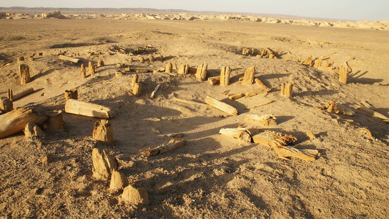
Lop Nur, located in the northeastern part of Ruoqiang County, was once the second largest saltwater lake in China. It has an altitude of 780 meters and an area of approximately 2,400-3,000 square kilometers. Lop Nur was born at the end of the Tertiary Period and the beginning of the Quaternary Period. It is 2 million years old and covers an area of more than 20,000 square kilometers.
In order to reveal the true face of Lop Nur, through the ages, countless explorers have given up their lives and forgot to go deep into it. There are no lack of tragic stories, and Lop Nur has put on a mysterious veil. Some people call the Lop Nur area a “devil’s triangle” on the Asian continent. The ancient Silk Road passed through it. Throughout the ages, many lone spirits and wild ghosts wandered here, with dead bones everywhere.
The strange mystery of Lop Nur:
In 1950, a guard of the People’s Liberation Army’s suppression force disappeared. After more than 30 years, the geological team discovered his body in Hongliugou, on the south bank of Lop Nur, more than 100 kilometers away from the accident site.
On June 17, 1980, the famous scientist Peng Jiamu disappeared during an expedition in Lop Nor. The country dispatched planes, troops, and police dogs, and spent a lot of manpower and material resources to conduct a carpet search, but found nothing.
In 1990, seven people in Hami took a passenger car to Lop Nur to look for the crystal mine, and they never returned. Two years later, people found 3 lying dead bodies under a steep slope. The car was 30 kilometers away from the dead, and the whereabouts of the others are unknown.
In the summer of 1995, three employees of Milan Farm went missing in a Beijing jeep to explore treasures in Lop Nur. Later explorers found the bodies of two of them 17 kilometers away from Loulan. The cause of death is unknown, and the whereabouts of the other is unknown. What is incredible is that their car is in good condition and there is no shortage of water and gasoline.
In June 1996, Chinese explorer Yu Chunshun was killed in a solo expedition on foot in Lop Nur. Due to deviation from the pre-planned route, no buried water and food were found, unfortunately, he was killed.
2. Altyn 阿尔金

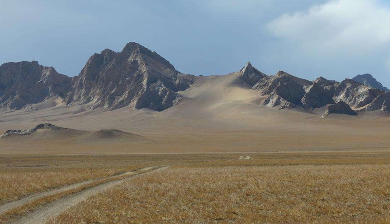
Altyn Nature Reserve is located in the north of East Kunlun Mountains in the south of Altun Mountains, from the border of Ruoqiang and Qiemo counties in the west, to the junction of Xinjiang and Qinghai provinces in the east, Qimantag in the south of Altun Mountains in the north, and Xinjiang in the south. The East Kunlun Mountains bordering Tibet are 360 kilometers long from east to west and 190 kilometers wide from north to south, with a total area of 44,940 square kilometers.
Altun Mountain Reserve is surrounded by high mountains. Modern glaciers, plateau lakes and plateau deserts, as well as a wide variety of Tibetan wild donkeys, Tibetan antelopes, wild yaks, wild camels and black-necked cranes, Tibetan snow roosters, white shoulder eagles, jade belt sea eagles and other rare birds and exotic animals, as well as 241 species of wild plants , The wonder of the plateau.
The “large arteries” in the plateau basin composed of the eight main rivers and numerous seasonal rivers in the Altun Mountain Reserve nourish the vast alpine pastures. The basin area of the eight major rivers amounts to 20,000 square kilometers. There are two main types of water supply for rivers, namely, glacial melt water and outcropping spring water. The rivers in the reserve have different shapes, some are turbulent, straight to the lagoon basin; some sometimes dive into the ground, sometimes emerge from the ground, and slowly gather in the depressions of the basin; some have pure water quality; some have a salinity of up to 71.5 g/l . The Sulu Betilek River is the largest river in the reserve. It originates from the north slope of the New Qingfeng Mountain and flows into the Ajak Kum Lake. It has a total length of 280 kilometers and a drainage area of 6,250 square kilometers.
3. Hoh Xil 可可西里

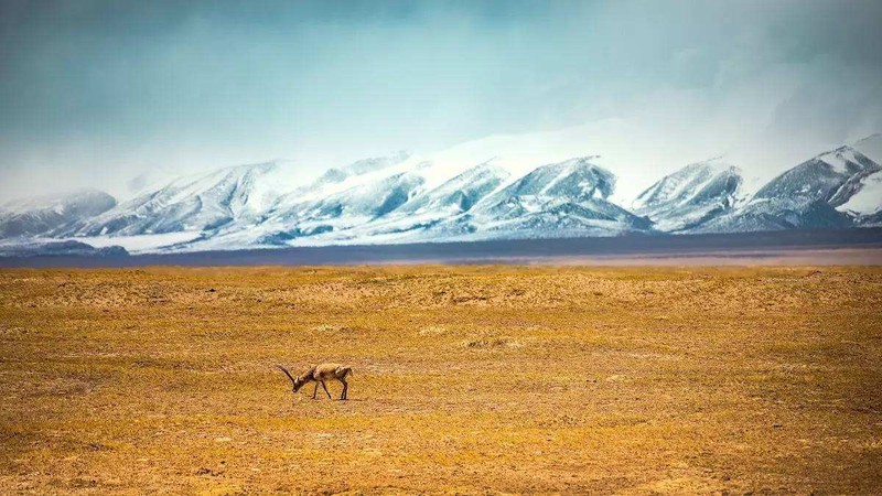
Hoh Xil Nature Reserve is located in Yushu Tibetan Autonomous Prefecture in the southwestern part of Qinghai Province, with 89˚25’~94˚05΄ east longitude and 34˚19’~36˚16˚ north latitude. Its scope is south of the Kunlun Mountains, north of Ulan Wula Mountain, from the Qinghai-Tibet Highway in the east and the provincial boundary in the west. The reserve is connected to the Tibet Autonomous Region in the west, Tanggula Township in Golmud in the south, Xinjiang Uygur Autonomous Region in the north, and Qinghai-Tibet Highway in the east, with a total area of 45,000 square kilometers.
Hoh Xil is located in the hinterland of the Qinghai-Tibet Plateau, with an average elevation above 4600 meters. The highest peak is the Bukadaban Peak (also known as Xinqingfeng or Monomaha Peak) on the northern edge of the Kunlun Mountain, with an elevation of 6860 meters; Shannanlu Hongshui River crosses Bokarek’s turn), 4200 meters above sea level. The terrain in the area is high in the north and south, low in the middle, high in the west and low in the east. Kekexili Mountain and Dongbule Mountain traverse the central part of this area. There are two broad valley lake basins between the mountains, and the terrain is relatively flat. There are modern glaciers in the mountains above 5500 meters to 6000 meters above sea level. For example, Bukadaban Peak (6860) meters, Malan Mountain (6813) meters, a small number of peaks over 5600 meters also have small-scale glaciers, such as Donggangzhari (5882) meters, the total area of glaciers is more than 1,700 square kilometers.
4. Tibet Qiangtang 西藏羌塘

The Tibet Qiangtang Nature Reserve is located in the Nagqu and Ngari regions of the Tibet Autonomous Region. The geographical coordinates are 79°42′-91°E and 32°10′-36°32’N, with a total area of 29.8 million hectares. It is the largest natural reserve in China. Sanctuary and the second nature reserve in the world after Greenland National Park. The reserve was established in 1993 with the approval of the People’s Government of the Tibet Autonomous Region. It is a nature reserve with plateau ecosystems and rare wild animals as its main protection objects.
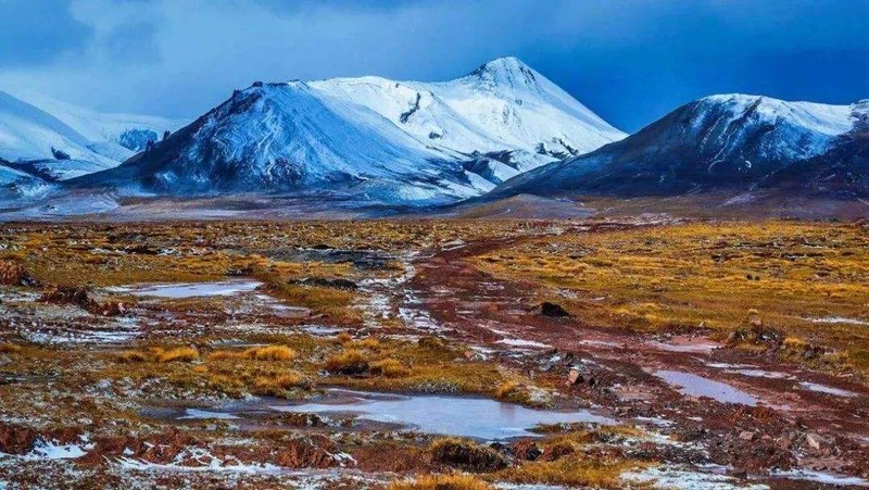
This area is located in the northwestern part of the Qinghai-Tibet Plateau. Its north, west and south sides are respectively surrounded by the Kunlun Mountains, Karakoram Mountains and Gangdise-Nyainqentanglha Mountains. It is a half enclosed plateau. The low mountains, hills and lakes in the area constitute an undulating ground with an average elevation of about 5,000 meters. The mountains are continuously distributed, and the relative elevation difference is generally between 200-1,000 meters. There are about 200 enclosed inland lakes larger than 1 square kilometer. . The vegetation types in the area are relatively simple, dominated by alpine desert grasslands. There are 470 species of seed plants in 40 families, 147 genera, and 28 species of vertebrates known as mammals, 92 species of birds, and 13 species of fish. There are more than 30 species of wild animals under national key protection, including Tibetan antelope, wild yak, snow leopard, Tibetan wild donkey, Tibetan antelope, and black-necked crane. Although the species of animals in this area are relatively poor, the animal population is large, and there are many endemic species belonging to the Qinghai-Tibet Plateau. For example, there are about 40,000 Tibetan antelopes, more than 10,000 wild yaks, and 30,000 to 40,000 Tibetan wild donkeys. head. The Qiangtang Nature Reserve has a unique ecosystem, rich in wild animal resources, and has extremely important protection value due to its uniqueness and ecological fragility. On the other hand, the plateau has peculiar topography, complex geological types, numerous glaciers and lakes, and well-preserved geological relics. It is of great value for studying the formation, evolution and development of the Qinghai-Tibet Plateau, as well as for scientific adventure tourism and ecotourism.