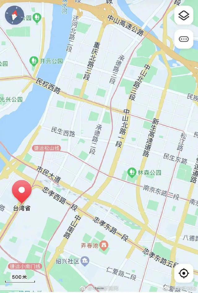
On the morning of August 5, the topic “Map can display every street in Taiwan Province” topped the Weibo hot search list. Searching for “Taiwan Province” through the mobile phone map software can fully display the map of Taiwan, accurate to the street traffic lights, and the real-time congestion situation of each road section.

Commonly used map software can retrieve detailed location information of Taiwan Province, including streets, buildings, and even small food shops.
Careful netizens found that the naming method of streets in Taiwan Province includes many familiar place names, such as Zhongxiao Road, Xinyi Road, Guangzhou Street, Changsha Street, Nanjing Road, Chongqing Road, etc. “Break the defense, it’s too familiar! It’s all the names of mainland cities.”
Someone once said that when you spread out a map of Taipei, take Zhongshan Road as the vertical axis and Zhongxiao Road as the horizontal axis, and draw a cross coordinate, you will find that in the southwest, there are Chengdu Road, Guiyang Road, and Liuzhou Street, and the northeast corner is Hidden in Jilin Road, Liaoning Road, Changchun Road, Ningbo Street and Shaoxing Road are not far from each other.
“Every road is the way home.” Some netizens said, “Taiwan is still the Taiwan we love, but ‘Taiwan independence’ is annoying.”
Some netizens laughed and said that when they saw the “Little Uniform Steak” and “Zhangjia Noodle House” on the map, they all wanted to eat it.
Search taiwan in map: https://map.baidu.com
https://www.gaode.com